
Post-Christmas snow will impact travel
Thursday December 25, 2025 — Christmas Day will be largely uneventful in terms of weather across Western New York. A cold front starved of moisture will drop across the region in the afternoon, bringing maybe just a few flurries, otherwise, expect seasonable temperatures in the 30s with a light breeze out of the northwest before colder air moves in for the evening.

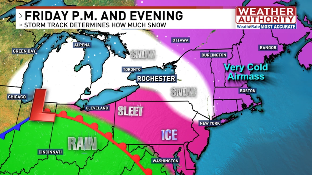
Conditions will change in a big way on Friday, however. Despite a fairly innocuous start to the day, an approaching clipper system from central Canada will dive through the lower Great Lakes and into the Ohio Valley. This system will bring an accumulating snowfall to much of Western New York and the Finger Lakes, but it will also bring sleet and freezing rain to parts of the region as well.

This system will move in with a northwest to southeast orientation with the attendant warm front hundreds of miles to our southwest. The line demarcating snow and ice will straddle parts of the Southern Tier and the Chautauqua ridge, while most of the rest of the region will receive some slushy snow (further west) or a more moderate, shovelable snow (north and east). Should this system track further west, more snow for all. Should it track further east, more ice and sleet, and less snow for all across the region. See some potential snow amounts for WNY below.

Snow_Accumulation GFS.png
This being said, if you are driving out of town on Friday, it will be best to leave in the morning to get ahead of as much of the system as possible. Flights will likely be impacted by this system as well.. The good news is that Saturday will be a much quieter day for travel.