ORLANDO, Fla. – Florida’s summer weather machine is locked in and running strong, with high heat, humidity and those familiar daily storms continuing into the weekend.
A broad area of high pressure is playing a big role in keeping our weather pattern steady.
[VIDEO BELOW: What’s next for the tropics?]
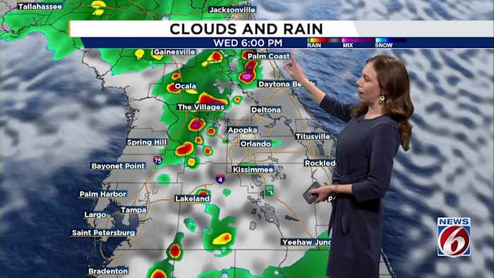
Expect another typical July day on Wednesday as we stay hot and humid with storms around.
Scattered afternoon and early evening storms will favor the inland region, with a 50-60% chance there and lower odds (30-50%) along the coast. Some of the stronger storms may bring brief wind gusts up to 45 mph, plenty of lightning and heavy downpours due to slow movement.
Heat index values could climb as high as 105 degrees in the Orlando area — and 109 in Lakeland — so be sure to stay hydrated and take breaks in the shade if you’re outside.
[BELOW: NSB looks to reduce flooding. Here’s how]
Looking ahead
Not much change is expected in the big-picture pattern.
An easterly wave in the Atlantic looks to get redirected north, meaning no major impacts locally.
The upper-level ridge will stay firmly in place over us, and this consistent weather feature means sea breezes will keep developing each day, helping to trigger afternoon storms.
Weekend outlook
Expect quick heating under sunny skies, pushing heat index values up to 105 degrees, with storm coverage increasing after 2 p.m. and lingering through sundown.
Copyright 2025 by WKMG ClickOrlando – All rights reserved.