
Now Reading: Environment Canada warns of possible thunderstorms in Okanagan
- 01
Environment Canada warns of possible thunderstorms in Okanagan

Environment Canada warns of possible thunderstorms in Okanagan
Thunderstorms may develop

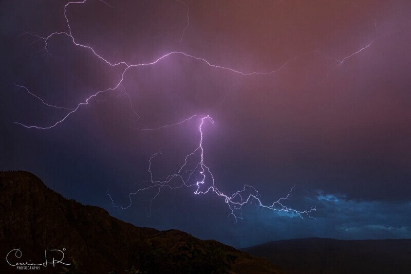
Photo: Cecelia Louis-Ralston
Lightning could return to the Okanagan Saturday.
Some welcome rain is falling across much of the Okanagan Saturday, but thunderstorms may follow later in the day.
Environment Canada has issued a severe thunderstorm watch for the Central and South Okanagan, along with the Boundary region.
“An upper level low is moving across southern B.C. today,” Environment Canada said.
“Showers and thunderstorms associated with this system could produce locally heavy rainfall, with rainfall rates potentially high enough to cause localized flash flooding, especially in areas with slow moving showers.”
While Environment Canada says “locally significant rainfall amounts are possible,” there remains uncertainty about the “exact location and magnitude of the heaviest rainfall, as convective showers and thunderstorms can be highly localized.”
The thunderstorm watch is expected to remain in place through the afternoon.
On Friday, Environment Canada meteorologist Brian Proctor told Castanet between five and 10 mm of rain is forecast to fall over the Okanagan on Saturday, although higher amounts are possible if thunderstorms develop.
It’s been a particularly dry summer so far, with just 1.8 mm of rain falling in Kelowna in August, prior to today, and just 0.5 mm falling in July.